GROT georadars application fields
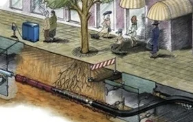
Underground and underwater communications and structures mapping
We create maps of underground engineering communications and structures built of any materials. We find places of underground communications leaks and localize the voids.
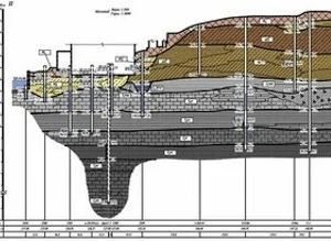
The condition of roads and foundations
We conduct non-destructive monitoring of the condition of the airports runways, roads and railway embankments as well as the monitoring of the underlying soils.
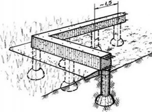
Pre-project work
We conduct research as a part of engineering and geological pre-building works during the construction of bridges, roads and other buildings. We determine the levels of the groundwater and the bearing capacity of soils, and also localize the abandoned mines, wells and underground workings position.

Search and evaluation of deposit reserves
We localize and delineate mineral deposits and evaluate the reserves of mineral resources and construction materials. We identify map and section positions of the frozen materials boundaries.
Treasures, underground tunnels, passages and burial sites localization
We determine the locations of treasures, archaeological and sunken objects and localize underground structures with the terrain relief binding.

Ecology
We localize and map the oil pollutions of soils and cellar areas of household and industrial waste polygons as well as evaluate the bottom sediments.